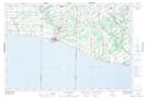
Maps showing Rowan Mills, Norfolk, Ontario
Rowan Mills is a Unincorporated area located in Norfolk, Ontario and has an elevation of 195 meters.
- Latitude: 42° 36' 55'' North (decimal: 42.6152777)
- Longitude: 80° 32' 24'' West (decimal: -80.5400000)
- Topography Feature Category: Unincorporated area
- Geographical Feature: Locality
- Canadian Province/Territory: Ontario
- Elevation: 195 meters
- Location: Norfolk
- Atlas of Canada Locator Map: Rowan Mills
- GPS Coordinate Locator Map: Rowan Mills Lat/Long