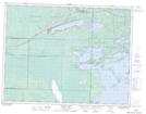
Maps showing Shoal Lake, Kenora, Ontario
Shoal Lake is a Unincorporated area located in Kenora, Ontario and has an elevation of 333 meters.
- Latitude: 49° 36' 54'' North (decimal: 49.6150000)
- Longitude: 95° 6' 33'' West (decimal: -95.1091666)
- Topography Feature Category: Unincorporated area
- Geographical Feature: Compact Rural Community
- Canadian Province/Territory: Ontario
- Elevation: 333 meters
- Location: Kenora
- Atlas of Canada Locator Map: Shoal Lake
- GPS Coordinate Locator Map: Shoal Lake Lat/Long