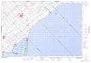
Maps showing Shrewsbury, Kent, Ontario
Shrewsbury is a Unincorporated area located in Kent, Ontario and has an elevation of 177 meters.
- Latitude: 42° 18' 2'' North (decimal: 42.3005555)
- Longitude: 81° 55' 30'' West (decimal: -81.9250000)
- Topography Feature Category: Unincorporated area
- Geographical Feature: Compact Rural Community
- Canadian Province/Territory: Ontario
- Elevation: 177 meters
- Location: Kent
- Atlas of Canada Locator Map: Shrewsbury
- GPS Coordinate Locator Map: Shrewsbury Lat/Long