Maps showing Siesta Shoal, Algoma, Ontario
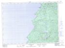
Siesta Shoal is a Shoal located in Algoma, Ontario.
- Latitude: 47° 8' 21'' North (decimal: 47.1391666)
- Longitude: 84° 51' 12'' West (decimal: -84.8533333)
- Topography Feature Category: Shoal
- Geographical Feature: Shoal
- Canadian Province/Territory: Ontario
- Location: Algoma
- Atlas of Canada Locator Map: Siesta Shoal
- GPS Coordinate Locator Map: Siesta Shoal Lat/Long
Siesta Shoal NTS Map Sheets