Canada Topographic Maps

Steele Topo Maps

Topography maps and Latitude/Longitude Location

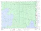
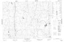
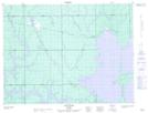
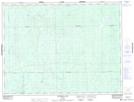
Maps showing Steele, Cochrane, Ontario

Steele is a Geographical area located in Cochrane, Ontario.

  • Latitude: 48° 58' 22'' North   (decimal: 48.9727777)
  • Longitude: 79° 56' 15'' West   (decimal: -79.9374999)
  • Topography Feature Category: Geographical area
  • Geographical Feature: Geographic Township
  • Canadian Province/Territory: Ontario
  • Location: Cochrane
  • Atlas of Canada Locator Map: Steele
  • GPS Coordinate Locator Map: Steele Lat/Long

Steele NTS Map Sheets

032D13 Aylen River Topographic Map at 1:50,000 scale

032E04 Abbotsford Lake Topographic Map at 1:50,000 scale

042A16 Low Bush Topographic Map at 1:50,000 scale

042H01 Mistango Lake Topographic Map at 1:50,000 scale

032D Rouyn-Noranda Topographic Map at 1:250,000 scale

032E Joutel Topographic Map at 1:250,000 scale

042A Timmins Topographic Map at 1:250,000 scale

042H Cochrane Topographic Map at 1:250,000 scale

 
Buy Topographic Maps DVD
Newsletter Sign-up

Yes, I want to receive map store discounts.


Bookmark and Share