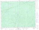
Maps showing Taradale, Thunder Bay, Ontario
Taradale is a Unincorporated area located in Thunder Bay, Ontario.
- Latitude: 49° 33' 44'' North (decimal: 49.5622222)
- Longitude: 85° 43' 42'' West (decimal: -85.7283333)
- Topography Feature Category: Unincorporated area
- Geographical Feature: Railway Point
- Canadian Province/Territory: Ontario
- Location: Thunder Bay
- Atlas of Canada Locator Map: Taradale
- GPS Coordinate Locator Map: Taradale Lat/Long
Taradale NTS Map Sheets