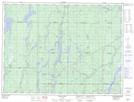
Maps showing The Cache, Timiskaming, Ontario
The Cache is a Unincorporated area located in Timiskaming, Ontario and has an elevation of 311 meters.
- Latitude: 48° 15' 40'' North (decimal: 48.2611111)
- Longitude: 81° 33' 34'' West (decimal: -81.5594444)
- Topography Feature Category: Unincorporated area
- Geographical Feature: Locality
- Canadian Province/Territory: Ontario
- Elevation: 311 meters
- Location: Timiskaming
- Atlas of Canada Locator Map: The Cache
- GPS Coordinate Locator Map: The Cache Lat/Long