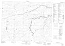
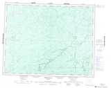
Maps showing Thunder House Falls, Cochrane, Ontario
Thunder House Falls is a Falls located in Cochrane, Ontario and has an elevation of 178 meters.
- Latitude: 50° 3' 13'' North (decimal: 50.0536111)
- Longitude: 83° 11' 17'' West (decimal: -83.1880555)
- Topography Feature Category: Falls
- Geographical Feature: Falls
- Canadian Province/Territory: Ontario
- Elevation: 178 meters
- Location: Cochrane
- Atlas of Canada Locator Map: Thunder House Falls
- GPS Coordinate Locator Map: Thunder House Falls Lat/Long
Thunder House Falls NTS Map Sheets