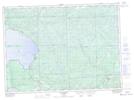
Maps showing Tilley Lakes, Algoma, Ontario
Tilley Lakes is a Lake located in Algoma, Ontario and has an elevation of 276 meters.
- Latitude: 47° 0' 8'' North (decimal: 47.0022222)
- Longitude: 84° 23' 35'' West (decimal: -84.3930555)
- Topography Feature Category: Lake
- Geographical Feature: Lakes
- Canadian Province/Territory: Ontario
- Elevation: 276 meters
- Location: Algoma
- Atlas of Canada Locator Map: Tilley Lakes
- GPS Coordinate Locator Map: Tilley Lakes Lat/Long
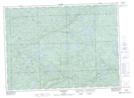
Tilley Lakes NTS Map Sheets