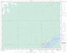
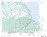
Maps showing Tomisidenik Island, Cochrane, Ontario
Tomisidenik Island is a Island located in Cochrane, Ontario and has an elevation of 5 meters.
- Latitude: 51° 17' 55'' North (decimal: 51.2986111)
- Longitude: 80° 31' 50'' West (decimal: -80.5305555)
- Topography Feature Category: Island
- Geographical Feature: Island
- Canadian Province/Territory: Ontario
- Elevation: 5 meters
- Location: Cochrane
- Atlas of Canada Locator Map: Tomisidenik Island
- GPS Coordinate Locator Map: Tomisidenik Island Lat/Long