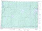
Maps showing Tom Smith Lake, Sudbury, Ontario
Tom Smith Lake is a Lake located in Sudbury, Ontario and has an elevation of 421 meters.
- Latitude: 48° 3' 28'' North (decimal: 48.0577777)
- Longitude: 82° 35' 34'' West (decimal: -82.5927777)
- Topography Feature Category: Lake
- Geographical Feature: Lake
- Canadian Province/Territory: Ontario
- Elevation: 421 meters
- Location: Sudbury
- Atlas of Canada Locator Map: Tom Smith Lake
- GPS Coordinate Locator Map: Tom Smith Lake Lat/Long
Tom Smith Lake NTS Map Sheets