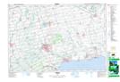
Maps showing Townsend Centre, Norfolk, Ontario
Townsend Centre is a Unincorporated area located in Norfolk, Ontario and has an elevation of 227 meters.
- Latitude: 42° 55' 58'' North (decimal: 42.9327777)
- Longitude: 80° 14' 49'' West (decimal: -80.2469444)
- Topography Feature Category: Unincorporated area
- Geographical Feature: Dispersed Rural Community
- Canadian Province/Territory: Ontario
- Elevation: 227 meters
- Location: Norfolk
- Atlas of Canada Locator Map: Townsend Centre
- GPS Coordinate Locator Map: Townsend Centre Lat/Long