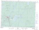
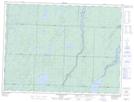
Maps showing Upper Windermere Lake, Sudbury, Ontario
Upper Windermere Lake is a Lake located in Sudbury, Ontario and has an elevation of 486 meters.
- Latitude: 48° 0' 12'' North (decimal: 48.0033333)
- Longitude: 83° 28' 26'' West (decimal: -83.4738888)
- Topography Feature Category: Lake
- Geographical Feature: Lake
- Canadian Province/Territory: Ontario
- Elevation: 486 meters
- Location: Sudbury
- Atlas of Canada Locator Map: Upper Windermere Lake
- GPS Coordinate Locator Map: Upper Windermere Lake Lat/Long
Upper Windermere Lake NTS Map Sheets