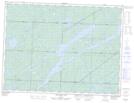
Maps showing Whitefish Falls, Sudbury, Ontario
Whitefish Falls is a Falls located in Sudbury, Ontario.
- Latitude: 48° 21' 25'' North (decimal: 48.3569444)
- Longitude: 83° 40' 23'' West (decimal: -83.6730555)
- Topography Feature Category: Falls
- Geographical Feature: Falls
- Canadian Province/Territory: Ontario
- Location: Sudbury
- Atlas of Canada Locator Map: Whitefish Falls
- GPS Coordinate Locator Map: Whitefish Falls Lat/Long
Whitefish Falls NTS Map Sheets