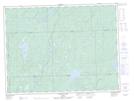
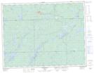
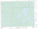
Maps showing White Owl Creek, Algoma, Ontario
White Owl Creek is a River located in Algoma, Ontario and has an elevation of 329 meters.
- Latitude: 49° 4' 37'' North (decimal: 49.0769444)
- Longitude: 84° 53' 53'' West (decimal: -84.8980555)
- Topography Feature Category: River
- Geographical Feature: Creek
- Canadian Province/Territory: Ontario
- Elevation: 329 meters
- Location: Algoma
- Atlas of Canada Locator Map: White Owl Creek
- GPS Coordinate Locator Map: White Owl Creek Lat/Long
White Owl Creek NTS Map Sheets