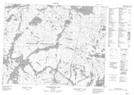
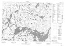
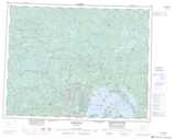
Maps showing Whitewater Lake, Thunder Bay, Ontario
Whitewater Lake is a Lake located in Thunder Bay, Ontario and has an elevation of 331 meters.
- Latitude: 50° 48' 35'' North (decimal: 50.8097222)
- Longitude: 89° 11' 35'' West (decimal: -89.1930555)
- Topography Feature Category: Lake
- Geographical Feature: Lake
- Canadian Province/Territory: Ontario
- Elevation: 331 meters
- Location: Thunder Bay
- Atlas of Canada Locator Map: Whitewater Lake
- GPS Coordinate Locator Map: Whitewater Lake Lat/Long
Whitewater Lake NTS Map Sheets