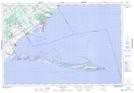
Maps showing Indian Creek Point, Norfolk, Ontario
Indian Creek Point is a Cape located in Norfolk, Ontario and has an elevation of 174 meters.
- Latitude: 42° 38' 58'' North (decimal: 42.6494444)
- Longitude: 80° 20' 57'' West (decimal: -80.3491666)
- Topography Feature Category: Cape
- Geographical Feature: Point
- Canadian Province/Territory: Ontario
- Elevation: 174 meters
- Location: Norfolk
- Atlas of Canada Locator Map: Indian Creek Point
- GPS Coordinate Locator Map: Indian Creek Point Lat/Long