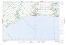
Maps showing Lawton's Corners, Elgin, Ontario
Lawton's Corners is a Unincorporated area located in Elgin, Ontario and has an elevation of 228 meters.
- Latitude: 42° 42' 10'' North (decimal: 42.7027777)
- Longitude: 81° 7' 20'' West (decimal: -81.1222222)
- Topography Feature Category: Unincorporated area
- Geographical Feature: Locality
- Canadian Province/Territory: Ontario
- Elevation: 228 meters
- Location: Elgin
- Atlas of Canada Locator Map: Lawton's Corners
- GPS Coordinate Locator Map: Lawton's Corners Lat/Long