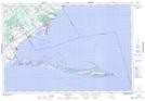
Maps showing Little Rice Bay Point, Norfolk, Ontario
Little Rice Bay Point is a Cape located in Norfolk, Ontario and has an elevation of 175 meters.
- Latitude: 42° 35' 22'' North (decimal: 42.5894444)
- Longitude: 80° 21' 30'' West (decimal: -80.3583333)
- Topography Feature Category: Cape
- Geographical Feature: Point
- Canadian Province/Territory: Ontario
- Elevation: 175 meters
- Location: Norfolk
- Atlas of Canada Locator Map: Little Rice Bay Point
- GPS Coordinate Locator Map: Little Rice Bay Point Lat/Long