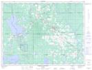
Maps showing Homestead Lake, Cochrane, Ontario
Homestead Lake is a Lake located in Cochrane, Ontario.
- Latitude: 48° 32' 10'' North (decimal: 48.5361111)
- Longitude: 80° 50' 27'' West (decimal: -80.8408333)
- Topography Feature Category: Lake
- Geographical Feature: Lake
- Canadian Province/Territory: Ontario
- Location: Cochrane
- Atlas of Canada Locator Map: Homestead Lake
- GPS Coordinate Locator Map: Homestead Lake Lat/Long
Homestead Lake NTS Map Sheets