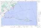
Maps showing The Home, Norfolk, Ontario
The Home is a Mountain located in Norfolk, Ontario and has an elevation of 174 meters.
- Latitude: 42° 33' 4'' North (decimal: 42.5511111)
- Longitude: 80° 6' 29'' West (decimal: -80.1080555)
- Topography Feature Category: Mountain
- Geographical Feature: Ridge
- Canadian Province/Territory: Ontario
- Elevation: 174 meters
- Location: Norfolk
- Atlas of Canada Locator Map: The Home
- GPS Coordinate Locator Map: The Home Lat/Long