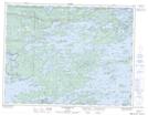
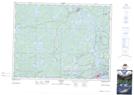
Maps showing Pellatt, Kenora, Ontario
Pellatt is a Geographical area located in Kenora, Ontario.
- Latitude: 49° 47' 35'' North (decimal: 49.7930555)
- Longitude: 94° 39' 43'' West (decimal: -94.6619444)
- Topography Feature Category: Geographical area
- Geographical Feature: Geographic Township
- Canadian Province/Territory: Ontario
- Location: Kenora
- Atlas of Canada Locator Map: Pellatt
- GPS Coordinate Locator Map: Pellatt Lat/Long
Pellatt NTS Map Sheets