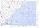
Maps showing Rondeau Bay, Kent, Ontario
Rondeau Bay is a Bay located in Kent, Ontario and has an elevation of 174 meters.
- Latitude: 42° 17' 51'' North (decimal: 42.2974999)
- Longitude: 81° 53' 19'' West (decimal: -81.8886111)
- Topography Feature Category: Bay
- Geographical Feature: Bay
- Canadian Province/Territory: Ontario
- Elevation: 174 meters
- Location: Kent
- Atlas of Canada Locator Map: Rondeau Bay
- GPS Coordinate Locator Map: Rondeau Bay Lat/Long