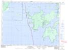
Maps showing Maple Islands, Kenora, Ontario
Maple Islands is a Island located in Kenora, Ontario and has an elevation of 333 meters.
- Latitude: 49° 1' 49'' North (decimal: 49.0302777)
- Longitude: 94° 31' 24'' West (decimal: -94.5233333)
- Topography Feature Category: Island
- Geographical Feature: Islands
- Canadian Province/Territory: Ontario
- Elevation: 333 meters
- Location: Kenora
- Atlas of Canada Locator Map: Maple Islands
- GPS Coordinate Locator Map: Maple Islands Lat/Long