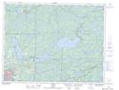
Maps showing Pelletier Bridge, Kenora, Ontario
Pelletier Bridge is a Unincorporated area located in Kenora, Ontario and has an elevation of 334 meters.
- Latitude: 49° 49' 16'' North (decimal: 49.8211111)
- Longitude: 94° 23' 40'' West (decimal: -94.3944444)
- Topography Feature Category: Unincorporated area
- Geographical Feature: Dispersed Rural Community
- Canadian Province/Territory: Ontario
- Elevation: 334 meters
- Location: Kenora
- Atlas of Canada Locator Map: Pelletier Bridge
- GPS Coordinate Locator Map: Pelletier Bridge Lat/Long