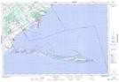
Maps showing Nanticoke Shoal, Norfolk, Ontario
Nanticoke Shoal is a Shoal located in Norfolk, Ontario.
- Latitude: 42° 44' 15'' North (decimal: 42.7375000)
- Longitude: 80° 4' 17'' West (decimal: -80.0713888)
- Topography Feature Category: Shoal
- Geographical Feature: Shoal
- Canadian Province/Territory: Ontario
- Location: Norfolk
- Atlas of Canada Locator Map: Nanticoke Shoal
- GPS Coordinate Locator Map: Nanticoke Shoal Lat/Long