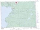
Maps showing Perry, Algoma, Ontario
Perry is a Unincorporated area located in Algoma, Ontario and has an elevation of 298 meters.
- Latitude: 47° 54' 14'' North (decimal: 47.9038888)
- Longitude: 84° 32' 5'' West (decimal: -84.5347222)
- Topography Feature Category: Unincorporated area
- Geographical Feature: Railway Point
- Canadian Province/Territory: Ontario
- Elevation: 298 meters
- Location: Algoma
- Atlas of Canada Locator Map: Perry
- GPS Coordinate Locator Map: Perry Lat/Long
Perry NTS Map Sheets