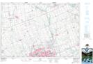
Maps showing Orchard Park, Middlesex, Ontario
Orchard Park is a Unincorporated area located in Middlesex, Ontario and has an elevation of 267 meters.
- Latitude: 43° 0' 2'' North (decimal: 43.0005555)
- Longitude: 81° 17' 36'' West (decimal: -81.2933333)
- Topography Feature Category: Unincorporated area
- Geographical Feature: Urban Community
- Canadian Province/Territory: Ontario
- Elevation: 267 meters
- Location: Middlesex
- Atlas of Canada Locator Map: Orchard Park
- GPS Coordinate Locator Map: Orchard Park Lat/Long
Orchard Park NTS Map Sheets