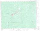
Maps showing Manitouwadge, Thunder Bay, Ontario
Manitouwadge is a Other municipal/district area - miscellaneous located in Thunder Bay, Ontario.
- Latitude: 49° 8' 29'' North (decimal: 49.1413888)
- Longitude: 85° 50' 40'' West (decimal: -85.8444444)
- Topography Feature Category: Other municipal/district area - miscellaneous
- Geographical Feature: Township Municipality
- Canadian Province/Territory: Ontario
- Location: Thunder Bay
- Atlas of Canada Locator Map: Manitouwadge
- GPS Coordinate Locator Map: Manitouwadge Lat/Long
Manitouwadge NTS Map Sheets