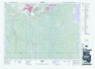
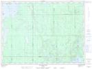
Maps showing St. Peter Bay, Timiskaming, Ontario
St. Peter Bay is a Bay located in Timiskaming, Ontario and has an elevation of 273 meters.
- Latitude: 48° 19' 46'' North (decimal: 48.3294444)
- Longitude: 80° 59' 4'' West (decimal: -80.9844444)
- Topography Feature Category: Bay
- Geographical Feature: Bay
- Canadian Province/Territory: Ontario
- Elevation: 273 meters
- Location: Timiskaming
- Atlas of Canada Locator Map: St. Peter Bay
- GPS Coordinate Locator Map: St. Peter Bay Lat/Long
St. Peter Bay NTS Map Sheets