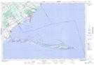
Maps showing St. Williams, Norfolk, Ontario
St. Williams is a Unincorporated area located in Norfolk, Ontario and has an elevation of 202 meters.
- Latitude: 42° 40' 3'' North (decimal: 42.6674999)
- Longitude: 80° 24' 54'' West (decimal: -80.4149999)
- Topography Feature Category: Unincorporated area
- Geographical Feature: Compact Rural Community
- Canadian Province/Territory: Ontario
- Elevation: 202 meters
- Location: Norfolk
- Atlas of Canada Locator Map: St. Williams
- GPS Coordinate Locator Map: St. Williams Lat/Long