Canada Topographic Maps

Saunders Pond Topo Maps

Topography maps and Latitude/Longitude Location

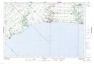
Maps showing Saunders Pond, Ontario

Saunders Pond is a Lake located in Ontario.

  • Latitude: 42° 42' 26'' North   (decimal: 42.7072000)
  • Longitude: 81° 10' 11'' West   (decimal: -81.1697000)
  • Topography Feature Category: Lake
  • Geographical Feature: Pond
  • Canadian Province/Territory: Ontario
  • GPS Coordinate Locator Map: Saunders Pond Lat/Long

Saunders Pond NTS Map Sheets

040I11 Port Stanley Topographic Map at 1:50,000 scale

040I Erie Topographic Map at 1:250,000 scale

 
Buy Topographic Maps DVD
Newsletter Sign-up

Yes, I want to receive map store discounts.


Bookmark and Share