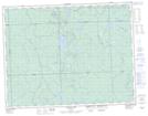
Maps showing Scottie Creek, Cochrane, Ontario
Scottie Creek is a River located in Cochrane, Ontario and has an elevation of 254 meters.
- Latitude: 49° 41' 10'' North (decimal: 49.6861111)
- Longitude: 84° 7' 57'' West (decimal: -84.1324999)
- Topography Feature Category: River
- Geographical Feature: Creek
- Canadian Province/Territory: Ontario
- Elevation: 254 meters
- Location: Cochrane
- Atlas of Canada Locator Map: Scottie Creek
- GPS Coordinate Locator Map: Scottie Creek Lat/Long
Scottie Creek NTS Map Sheets