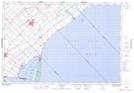
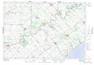
Maps showing Morden Drain, Kent; Elgin, Ontario
Morden Drain is a Hydraulic construction located in Kent; Elgin, Ontario and has an elevation of 208 meters.
- Latitude: 42° 28' 20'' North (decimal: 42.4722222)
- Longitude: 81° 40' 10'' West (decimal: -81.6694444)
- Topography Feature Category: Hydraulic construction
- Geographical Feature: Drain
- Canadian Province/Territory: Ontario
- Elevation: 208 meters
- Location: Kent; Elgin
- Atlas of Canada Locator Map: Morden Drain
- GPS Coordinate Locator Map: Morden Drain Lat/Long
Morden Drain NTS Map Sheets