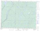
Maps showing Shawmere, Sudbury, Ontario
Shawmere is a Unincorporated area located in Sudbury, Ontario and has an elevation of 311 meters.
- Latitude: 48° 20' 22'' North (decimal: 48.3394444)
- Longitude: 82° 32' 31'' West (decimal: -82.5419444)
- Topography Feature Category: Unincorporated area
- Geographical Feature: Dispersed Rural Community
- Canadian Province/Territory: Ontario
- Elevation: 311 meters
- Location: Sudbury
- Atlas of Canada Locator Map: Shawmere
- GPS Coordinate Locator Map: Shawmere Lat/Long