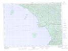
Maps showing Pamplemouse Pond, Algoma, Ontario
Pamplemouse Pond is a Lake located in Algoma, Ontario and has an elevation of 302 meters.
- Latitude: 47° 27' 27'' North (decimal: 47.4575000)
- Longitude: 84° 44' 38'' West (decimal: -84.7438888)
- Topography Feature Category: Lake
- Geographical Feature: Pond
- Canadian Province/Territory: Ontario
- Elevation: 302 meters
- Location: Algoma
- Atlas of Canada Locator Map: Pamplemouse Pond
- GPS Coordinate Locator Map: Pamplemouse Pond Lat/Long
Pamplemouse Pond NTS Map Sheets