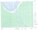
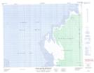
Maps showing Rivière Missisicabi, Cochrane, Ontario
Rivière Missisicabi is a River located in Cochrane, Ontario and has an elevation of 0 meters.
- Latitude: 51° 15' 26'' North (decimal: 51.2572222)
- Longitude: 79° 40' 39'' West (decimal: -79.6775000)
- Topography Feature Category: River
- Geographical Feature: Rivière
- Canadian Province/Territory: Ontario
- Elevation: 0 meters
- Location: Cochrane
- Atlas of Canada Locator Map: Rivière Missisicabi
- GPS Coordinate Locator Map: Rivière Missisicabi Lat/Long
Rivière Missisicabi NTS Map Sheets