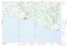
Maps showing South Otter Creek, Elgin; Norfolk, Ontario
South Otter Creek is a River located in Elgin; Norfolk, Ontario and has an elevation of 182 meters.
- Latitude: 42° 38' 38'' North (decimal: 42.6438888)
- Longitude: 80° 47' 38'' West (decimal: -80.7938888)
- Topography Feature Category: River
- Geographical Feature: Creek
- Canadian Province/Territory: Ontario
- Elevation: 182 meters
- Location: Elgin; Norfolk
- Atlas of Canada Locator Map: South Otter Creek
- GPS Coordinate Locator Map: South Otter Creek Lat/Long