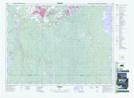
Maps showing Mattagami Heights, Ontario
Mattagami Heights is a Unincorporated area located in Ontario.
- Latitude: 48° 28' 40'' North (decimal: 48.4777999)
- Longitude: 81° 21' 45'' West (decimal: -81.3624999)
- Topography Feature Category: Unincorporated area
- Geographical Feature: Urban Community
- Canadian Province/Territory: Ontario
- GPS Coordinate Locator Map: Mattagami Heights Lat/Long