Canada Topographic Maps

Caddy-Bott Drain Topo Maps

Topography maps and Latitude/Longitude Location

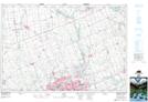
Maps showing Caddy-Bott Drain, Ontario

Caddy-Bott Drain is a Hydraulic construction located in Ontario.

  • Latitude: 42° 59' 40'' North   (decimal: 42.9943999)
  • Longitude: 81° 0' 28'' West   (decimal: -81.0077999)
  • Topography Feature Category: Hydraulic construction
  • Geographical Feature: Drain
  • Canadian Province/Territory: Ontario
  • GPS Coordinate Locator Map: Caddy-Bott Drain Lat/Long

Caddy-Bott Drain NTS Map Sheets

040I14 St Thomas Topographic Map at 1:50,000 scale

040P03 Lucan Topographic Map at 1:50,000 scale

040I Erie Topographic Map at 1:250,000 scale

040P Kitchener Topographic Map at 1:250,000 scale

 
Buy Topographic Maps DVD
Newsletter Sign-up

Yes, I want to receive map store discounts.


Bookmark and Share