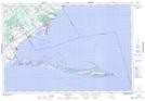
Maps showing Fishers Creek, Norfolk, Ontario
Fishers Creek is a River located in Norfolk, Ontario and has an elevation of 208 meters.
- Latitude: 42° 43' 11'' North (decimal: 42.7197222)
- Longitude: 80° 17' 34'' West (decimal: -80.2927777)
- Topography Feature Category: River
- Geographical Feature: Creek
- Canadian Province/Territory: Ontario
- Elevation: 208 meters
- Location: Norfolk
- Atlas of Canada Locator Map: Fishers Creek
- GPS Coordinate Locator Map: Fishers Creek Lat/Long