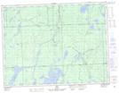
Maps showing The Expansion, Algoma, Ontario
The Expansion is a River feature located in Algoma, Ontario and has an elevation of 313 meters.
- Latitude: 49° 4' 45'' North (decimal: 49.0791666)
- Longitude: 84° 20' 25'' West (decimal: -84.3402777)
- Topography Feature Category: River feature
- Geographical Feature: Reach
- Canadian Province/Territory: Ontario
- Elevation: 313 meters
- Location: Algoma
- Atlas of Canada Locator Map: The Expansion
- GPS Coordinate Locator Map: The Expansion Lat/Long