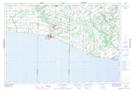
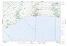
Maps showing Malahide, Elgin, Ontario
Malahide is a Other municipal/district area - miscellaneous located in Elgin, Ontario.
- Latitude: 42° 47' 35'' North (decimal: 42.7930555)
- Longitude: 80° 56' 10'' West (decimal: -80.9361111)
- Topography Feature Category: Other municipal/district area - miscellaneous
- Geographical Feature: Township Municipality
- Canadian Province/Territory: Ontario
- Location: Elgin
- Atlas of Canada Locator Map: Malahide
- GPS Coordinate Locator Map: Malahide Lat/Long
Malahide NTS Map Sheets