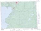
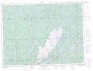
Maps showing Michipicoten, Algoma, Ontario
Michipicoten is a Other municipal/district area - miscellaneous located in Algoma, Ontario.
- Latitude: 48° 1' 39'' North (decimal: 48.0274999)
- Longitude: 84° 48' 38'' West (decimal: -84.8105555)
- Topography Feature Category: Other municipal/district area - miscellaneous
- Geographical Feature: Township Municipality
- Canadian Province/Territory: Ontario
- Location: Algoma
- Atlas of Canada Locator Map: Michipicoten
- GPS Coordinate Locator Map: Michipicoten Lat/Long
Michipicoten NTS Map Sheets