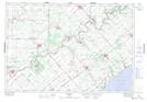
Maps showing Port Glasgow, Elgin, Ontario
Port Glasgow is a Unincorporated area located in Elgin, Ontario and has an elevation of 183 meters.
- Latitude: 42° 30' 35'' North (decimal: 42.5097222)
- Longitude: 81° 36' 41'' West (decimal: -81.6113888)
- Topography Feature Category: Unincorporated area
- Geographical Feature: Dispersed Rural Community
- Canadian Province/Territory: Ontario
- Elevation: 183 meters
- Location: Elgin
- Atlas of Canada Locator Map: Port Glasgow
- GPS Coordinate Locator Map: Port Glasgow Lat/Long