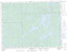
Maps showing Tower Hill, Algoma, Ontario
Tower Hill is a Mountain located in Algoma, Ontario and has an elevation of 437 meters.
- Latitude: 49° 12' 40'' North (decimal: 49.2111111)
- Longitude: 85° 8' 15'' West (decimal: -85.1375000)
- Topography Feature Category: Mountain
- Geographical Feature: Hill
- Canadian Province/Territory: Ontario
- Elevation: 437 meters
- Location: Algoma
- Atlas of Canada Locator Map: Tower Hill
- GPS Coordinate Locator Map: Tower Hill Lat/Long
Tower Hill NTS Map Sheets