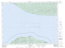
Maps showing Ganley Harbour Wilderness Area, Thunder Bay, Ontario
Ganley Harbour Wilderness Area is a Conservation area located in Thunder Bay, Ontario and has an elevation of 203 meters.
- Latitude: 47° 56' 4'' North (decimal: 47.9344444)
- Longitude: 85° 43' 18'' West (decimal: -85.7216666)
- Topography Feature Category: Conservation area
- Geographical Feature: Wilderness Area
- Canadian Province/Territory: Ontario
- Elevation: 203 meters
- Location: Thunder Bay
- Atlas of Canada Locator Map: Ganley Harbour Wilderness Area
- GPS Coordinate Locator Map: Ganley Harbour Wilderness Area Lat/Long
Ganley Harbour Wilderness Area NTS Map Sheets