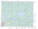
Maps showing The Jones Road Wilderness Area, Kenora, Ontario
The Jones Road Wilderness Area is a Conservation area located in Kenora, Ontario and has an elevation of 398 meters.
- Latitude: 49° 54' 57'' North (decimal: 49.9158333)
- Longitude: 94° 7' 47'' West (decimal: -94.1297222)
- Topography Feature Category: Conservation area
- Geographical Feature: Wilderness Area
- Canadian Province/Territory: Ontario
- Elevation: 398 meters
- Location: Kenora
- Atlas of Canada Locator Map: The Jones Road Wilderness Area
- GPS Coordinate Locator Map: The Jones Road Wilderness Area Lat/Long