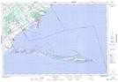
Maps showing Turkey Point Wilderness Area, Norfolk, Ontario
Turkey Point Wilderness Area is a Conservation area located in Norfolk, Ontario.
- Latitude: 42° 41' North (decimal: 42.6833000)
- Longitude: 80° 20' West (decimal: -80.3333000)
- Topography Feature Category: Conservation area
- Geographical Feature: Wilderness Area
- Canadian Province/Territory: Ontario
- Location: Norfolk
- Atlas of Canada Locator Map: Turkey Point Wilderness Area
- GPS Coordinate Locator Map: Turkey Point Wilderness Area Lat/Long