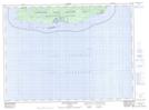
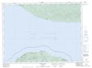
Maps showing Michipicoten Island Provincial Park, Thunder Bay, Ontario
Michipicoten Island Provincial Park is a Conservation area located in Thunder Bay, Ontario and has an elevation of 266 meters.
- Latitude: 47° 45' 4'' North (decimal: 47.7511111)
- Longitude: 85° 46' 36'' West (decimal: -85.7766666)
- Topography Feature Category: Conservation area
- Geographical Feature: Provincial Park
- Canadian Province/Territory: Ontario
- Elevation: 266 meters
- Location: Thunder Bay
- Atlas of Canada Locator Map: Michipicoten Island Provincial Park
- GPS Coordinate Locator Map: Michipicoten Island Provincial Park Lat/Long
Michipicoten Island Provincial Park NTS Map Sheets